Solutions for
Renewable Developers
Strategic project siting and grid connection optimization for the renewable energy transition.
Turn Grid Constraints into Competitive Advantages
The Iberian grid is undergoing historic change. With eRoots Map and VeraGrid, renewable energy developers can navigate congestion, identify optimal project locations, and maximize revenue potential.
-
Strategic Locations Identify high-capacity grid zones with low curtailment risk
-
Revenue Optimization Maximize project revenue through strategic siting
-
Risk Mitigation Avoid congested areas and connection delays
-
Faster Approvals Align projects with grid needs for faster approvals
The Challenge: Grid Saturation & Curtailment Risk
Spain and Portugal are experiencing unprecedented renewable growth, but the grid infrastructure hasn't kept pace. Developers face:
-
Connection Barriers Connection refusals in saturated zones
-
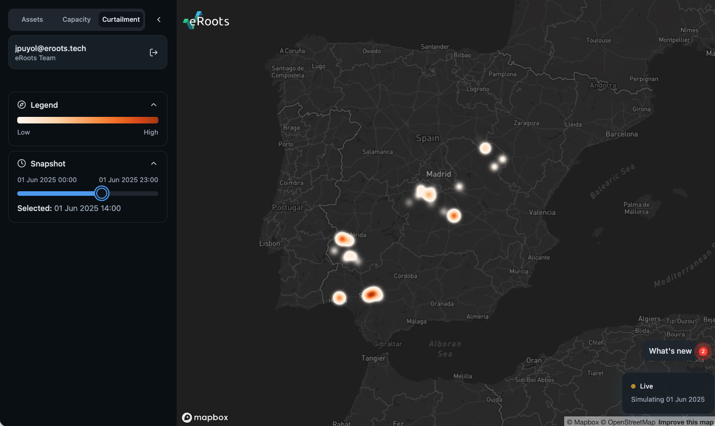
Revenue Loss High curtailment risk reducing project revenues
-
Reinforcement Delays Multi-year delays for grid reinforcements
-
Price Volatility Negative prices in oversupplied regions
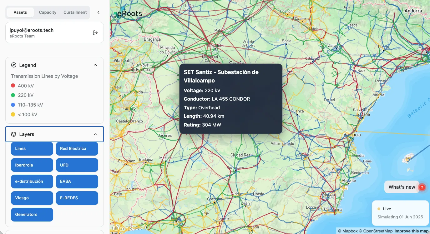
The Solution: Data-Driven Project Siting
eRoots Map provides a comprehensive view of the Iberian grid, combining real-time capacity data with future scenario modeling:
-
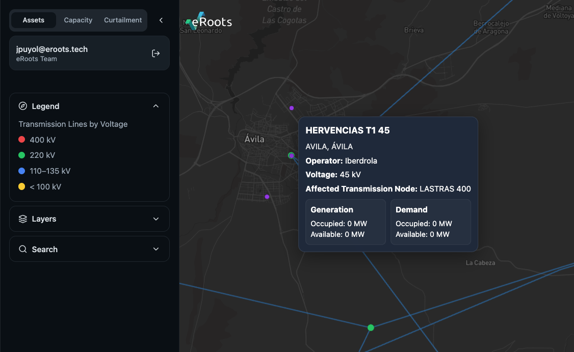
Hosting Capacity Maps See exactly where the grid can accommodate new generation
-
5-Year Forward View Visualize committed grid upgrades and future developments
-
Curtailment Forecasting Predict and quantify revenue risk by location
-
Geospatial Intelligence Cross-reference grid data with land availability and regulations
Ready to Optimize Your Renewable Projects?
Join leading renewable developers using eRoots to make data-driven siting decisions and maximize project success.
Request a Demo